Measure
The Length and Area measure tools will calculate the length, in one dimension, or area, in two dimensions, for a given section of the map.
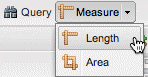
Length
The Length tool will measure directly on the Map Window. The measurement value represents the sum of one or more line segments or curves.
To activate the Length measure tool, click Measure on the GeoExplorer toolbar and then click Length.
Length measure tool
To start the measurement, click a location on the map. As you move the mouse from that location, a dashed line will extend from the initial point. Click somewhere else on the map to create a second point. The length of the line segment between the two points will be displayed (in both kilometers and miles) in the Measure length pop-up window. To continue the measurement, click additional points on the map. The reported length will be the cumulative total of the length of all line segments.
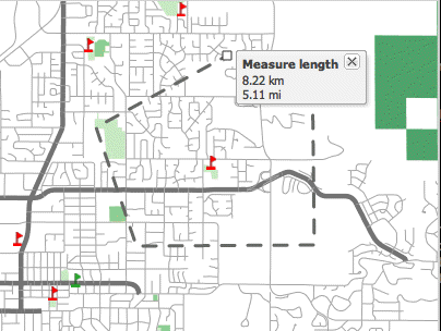
Length measurement with line segments
To finish measuring the length, double-click a location on the map. The measured line will disappear from the Map Window when the Measure length pop-up window is closed.
Sometimes straight line segments may not be the best option for measuring length, so measurement by freehand drawing is also supported. To activate freehand drawing, hold down Shift, click, and hold down the left mouse button while moving the mouse around the map. The dashed line will follow the mouse movements. You can combine line segments and freehand drawing in the same measurement.
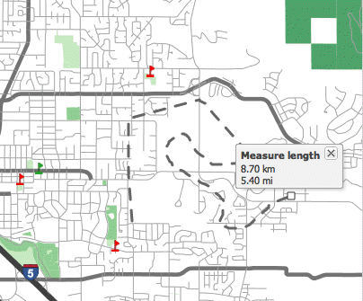
Length measurement with freehand drawing
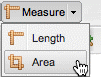
Area
The Area tool measures directly on the Map Window. The measurement value represents the area of a polygon made up of one or more line segments or curves.
To activate the Area measure tool, click Measure on the GeoExplorer toolbar and then click Area.
Area measure tool
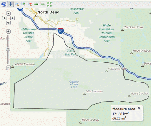
To start the measurement, click a location on the map. As you move the mouse away from that point, a solid line will extend from the initial point. Click again to create a second point. These points will become the vertices of the polygon that will be measured. To continue the measurement, click additional points on the map. After three vertices have been added to the map, the current area measurement will be displayed (in both square kilometers and square miles) in the Measure area pop-up window.
To finish measuring the area, double-click a location on the map. The measured area outline will disappear from the Map Window when the Measure area pop-up window is closed.
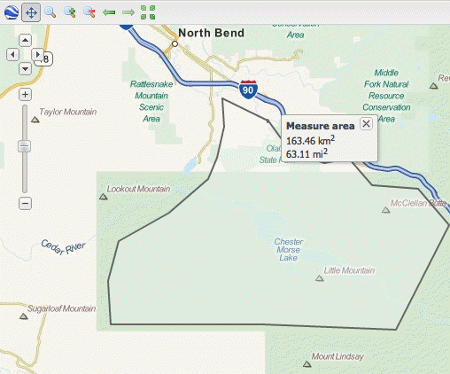
Area measurement with a polygon
Sometimes straight line segments may not be the best option for measuring area, so measurement by freehand drawing is also supported. To activate freehand drawing, hold down Shift, click, and hold down the left mouse button while moving the mouse around the map. The solid line will follow the mouse movements. You can combine line segments and freehand drawing in the same measurement.
Area measurement with freehand drawing