Transform
Description
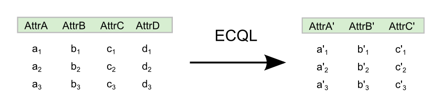
The vec:Transform process operates on a feature collection using a series of expressions. This process is equivalent to the SELECT ... FROM clause in SQL, allowing you to define a new feature collection with attributes computed from some, or all, of the input feature collection. The new attributes are computed via ECQL expressions which can process geometry as well as scalar data.
The transform string is a sequence of specifiers in the form name=expression. The name attribute is the name of an attribute used in the output feature collection, and expression is an ECQL expression using the input attributes and constants.
vec:Transform
Inputs and outputs
vec:Transform accepts Feature collection inputs and returns Feature collection outputs.
Inputs
| Name | Description | Type | Usage |
|---|---|---|---|
features |
Input feature collection | SimpleFeatureCollection | Required |
transform |
Transform specification—List of specifiers (name=expression) delimited by newlines or semicolons |
String | Required |
Outputs
| Name | Description | Type |
|---|---|---|
result |
Transformed feature collection | SimpleFeatureCollection |
Usage notes
- The expressions used in the
transformparameter can use all the elements of the ECQL query language. - Some of the available processes are based on, or have similar, functionality to GeoServer filter functions. Those functions may be used in
transformparameter expressions.
Examples
The following examples illustrate how to use the vec:Transform process. All of the examples use the medford:bikelanes feature collection, with different expressions for the transform parameter.
- A new feature collection with a single attribute containing the name of the street each bike lane is on:
transform:the_geom=the_geom; streetname=streetname
- Same as example 1 only renaming the attribute name to
street_name:transform:the_geom=the_geom; street_name=streetname
- Same as example 1 only adding in the length of the feature:
transform:the_geom=the_geom; street_name=streetname; length = length(the_geom)
- Same as example 1 only adding an attribute called
difcontaining the difference between the computed length and the value in thelenattribute of the original input layer:transform:the_geom=the_geom; street_name=streetname; length = length(the_geom); dif=length(the_geom)-len
- A new feature collection containing the x and y coordinates of both the start and end points of the bike lane, in addition to an attribute with the name of the street each bike lane is on:
transform:the_geom=the_geom; x1=getX(startPoint(the_geom)); y1=getY(startPoint(the_geom)); x2=getX(endPoint(the_geom)); y2=getY(endPoint(the_geom)); streetname=streetname
- Using the resulting feature collection from example 5 as input instead of
medford:bikelanes, this example will replace the original geometry by a straight line between the start and end points, and add an attribute for the street name.transform:the_geom=geomFromWKT(Concatenate('LINESTRING(' ,x1, ' ', y1, ', ', x2, ' ', y2,')')); streetname=streetname